Short note: This website is in Beta - we are currently building everything up but you can already find the apps to download and participate! Thank you and stay safe!

Super User
Foto der Beobachtung

Mache ein Foto vom Beobachtungsort. Stelle sicher, dass andere Citizen Scientists den Standort leicht erkennen können, indem Du einige Referenzobjekte in das Bild einfügst.
Du kannst auch ein passendes Foto aus deinem Album auswählen. Bitte adaptiere in diesem Fall das Datum und die Uhrzeit deiner Beobachtung, bevor du den Spot speicherst.
Ảnh chụp tại vị trí quan sát
Chụp các bức ảnh tại địa điểm quan sát. Đảm bảo rằng các nhà khoa học cộng đồng khác có thể dễ dàng nhận ra địa điểm bằng cách đưa một số đối tượng tham chiếu vào hình ảnh.
Bạn cũng có thể chọn những bức ảnh phù hợp từ Bộ sưu tập ảnh trong điện thoại của mình. Trong trường hợp này, vui lòng điều chỉnh ngày giờ quan sát cho phù hợp trước khi lưu thông tin.
Green Growth Wildlife
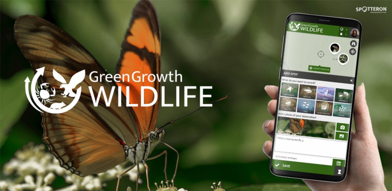
Suriname's lush forests are home to a plethora of unique flora and animals. Despite this abundance, there is still a lack of a unified system that consolidates all critical information in a single, easily accessible location. This is where the Green Growth Wildlife app comes in, providing a complete platform for collecting vital information that will help map and understand the health of Suriname's biodiversity.
A Citizen Science App to Map Suriname's Abundant Wildlife
The aim for the future is to build an engaged community of Citizen Scientists who will act as the eyes and ears of our 93 percent wooded Suriname by routinely updating the app with their observations, thus giving scientists a complete view of Suriname's wildlife. These data will help Suriname's policymakers manage biodiversity sustainably.
Photo of the observation

Take a photo of the observation site. Make sure that other citizen scientists can easily recognize the site by including some reference objects in the picture.
You can also choose a suitable photo from your album. In this case, please adjust date and time of your observation before saving the spot.
MTA Mountain App
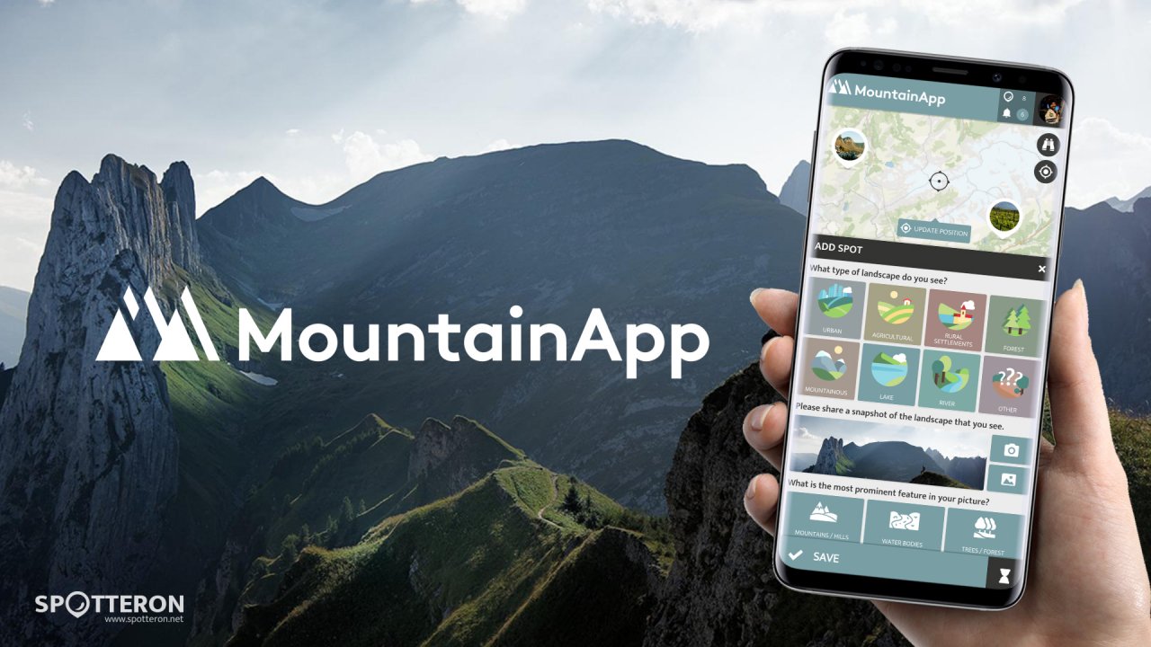
Share your landscape! Explore mountainous landscapes all over Europe.
MTA - MountainApp wants to inspire people to immerse themselves in landscapes. MTA - MountainApp is a project jointly run by researchers from Switzerland and Georgia. MTA - MountainApp was developed for a transnational research seminar taught at the University of Zurich and the Ivane Javakhishvili Tbilisi State University. The app is used to facilitate cross-border student collaboration and learning and to introduce students to sustainable mountain development through the lens of the Alpine and Caucasus mountains.
Mountain App is interested in learning more about places and landscapes people visit and experience in their everyday lives. By collecting this data, we want to better understand people’s relationships to different kinds of landscapes and landscape elements. With a focus on these relationships, the project aims to analyze values and meanings attached to landscapes and wants to draw attention to contemporary challenges of mountainous regions and bring people living in these areas closer together. Fun fact: “Mta” is the Georgian term for “mountain”!
CiVo Citizen Voice
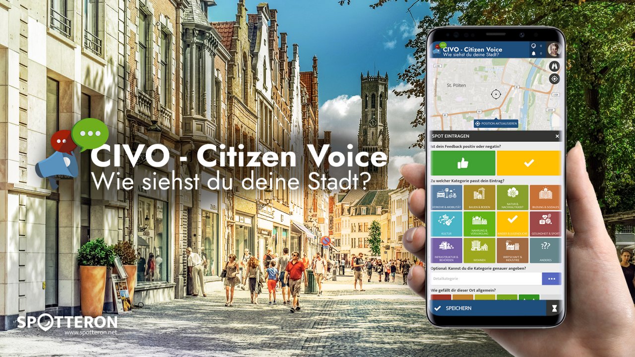
The new citizen participation uses "Citizen Science" in their hometown and nationwide to get your feedback on places. As a result, citizens are empowered to become active in a city worth living in to collect and share data themselves and to interact with scientists. This enables them to recognize the consequences of sealing, heat, water shortages, and a lack of biodiversity, and generally, how places in their own environment affect us all.
People must be given the opportunity to take part in meaningful projects themselves and to discover for themselves what climate, environmental, and transport policies really mean for them and their direct living environment. Together with the St. Pölten citizens' platform, we are starting a first test project for more citizen participation and feedback to the city administrations.
Fridays for Future Climate App
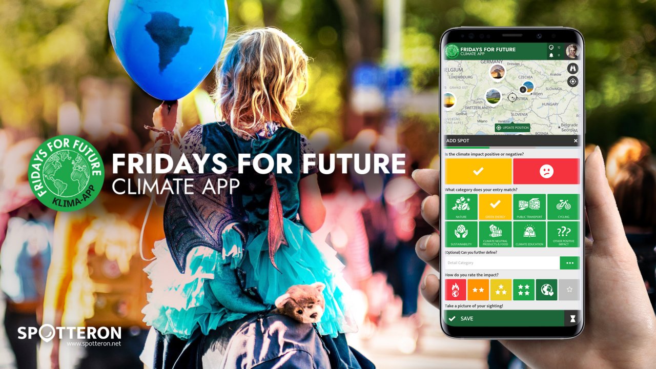
Fridays for Future sees itself as a horizontal, grassroots movement that acts impartially and refers to science for the facts. To engage the global population more, this app was developed using SPOTTERON. The aim is to find out how the climate crisis is perceived by the population and which positive and negative emotions are associated with certain topics related to the biodiversity and climate crisis.
The users should learn more about the climate crisis and at the same time be able to make a small contribution to climate protection. With the app, Fridays for Future wants to bring people closer to the climate crisis in everyday life in order to emphasize certain factors more consciously. At the same time, the app is intended to integrate everyone with the help of the Citizen Science project (SPOTTERON) by allowing the user to document what he/she notices about the climate crisis in the most accessible way possible. It is important that not only the negative aspects are noted, but that positive events also flow into the project. With this app you can upload material on the topics of "nature", "green energy", "public transport" and "other positive influences", among other things. The negative aspects are addressed with the topics of "construction", "road traffic", "environmental destruction" and "other negative influences". Then, on a scale of 1 to 5, the extent to which this has an impact on the climate crisis should be assessed.
This data is used anonymously by a wide variety of scientists to better understand the climate crisis and the associated changes. The users should learn more about the climate crisis and at the same time be able to make a small contribution to climate protection.
HydroCrowd
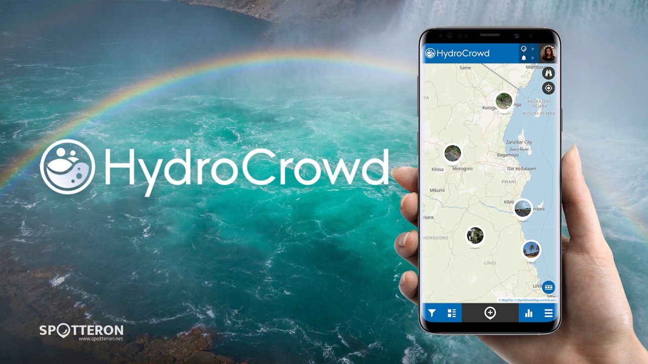
With HydroCrowd, Citizen Scientists can make a real impact by monitoring rainfall and other hydro-climatic data in Ecuador, Honduras, and Tanzania. No need to be a weather expert—just grab the app and get ready to dive into the world of water!
Swan plant
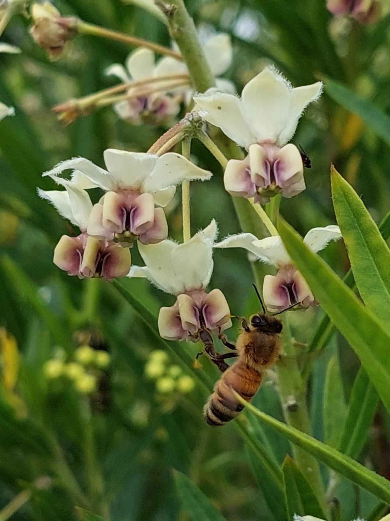
Tall, single-stemmed perennial. Sparse foliage. Narrow leaves. White 'upside-down' flowers found in dropping bunches. Seed pods are large round inflated balls with multiple hairs.
Lavender
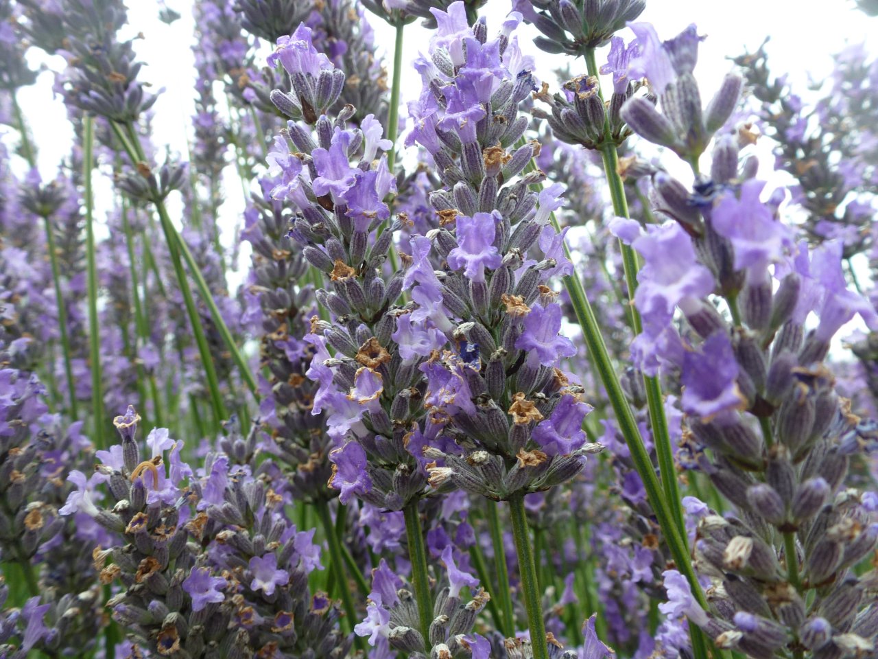
Grey-green smaller leaves (30 - 50 mm) Purple flowers on long stalks. Each flower head is made up of multiple small flowers. Distinctive fragrance.
Please visit the website about the SPOTTERON Platform on www.spotteron.net
This website uses no external trackers, no analytics, just session cookies and values your online privacy.