A water level gauge can be used to measure the water level in a river. By taking regular measurements, you can record the changes in water level over time. The scale on the water level gauge is in centimeters (cm). This is one type of water level gauge, where each mark is 1 centimeter wide:
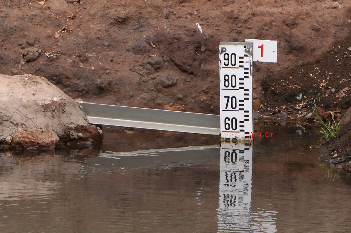
In this example, the water level is 56 cm (4 cm below 60). This is the value you enter as 'Water level value' in the app.
In the case that the water level of a river can rise above 1 meter (100 cm), several water level gauges will be mounted on top or diagonally above each other:
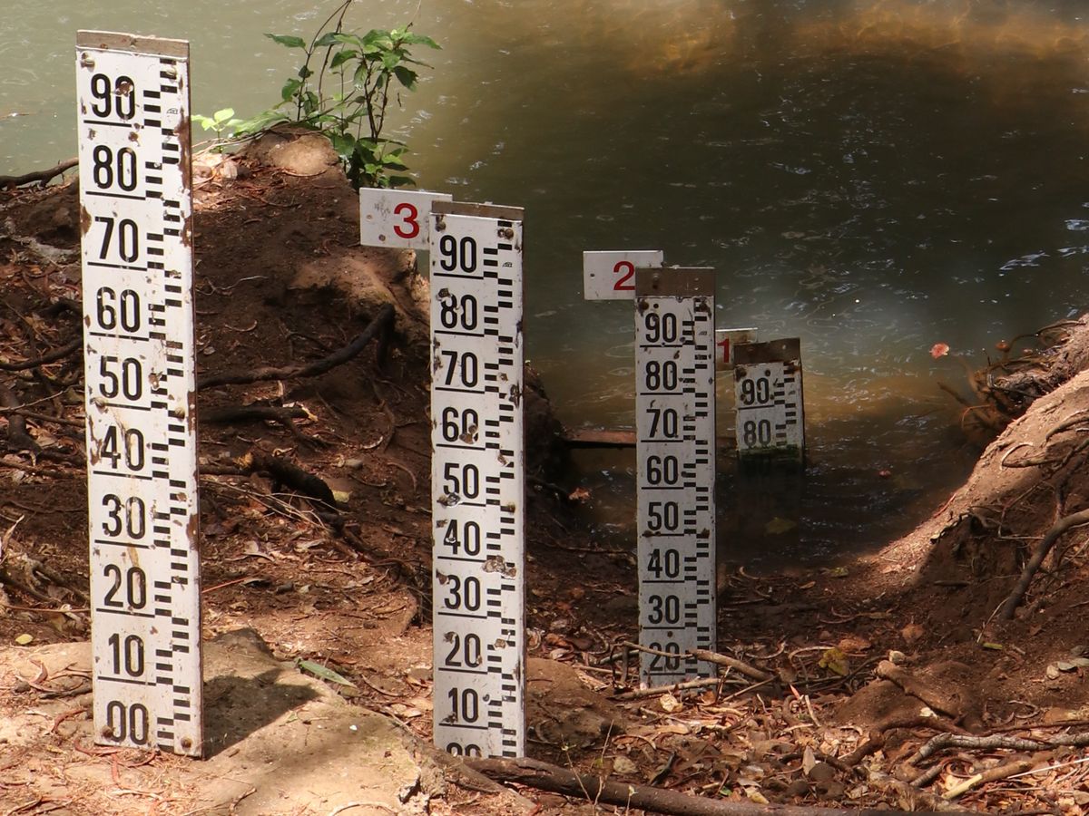
Then the number on top will tell you the maximum water level that can be measured at that particular gauge in meters. In the example above, it is 1 m. This is the value you enter as the 'Gauge number' in the app.